

You are encouraged to share this post with your friends, acquaintances, colleagues and family by all channels available to you.
News posts, such as this, published on the SBARC website are reposted via a number of other channels including social media feeds and our Groups.io mailing lists. These external services may alter the formatting or layout of the original News Post. If you want to see this News Post in its original form please visit the SBARC website News page and follow the link or links to the story or stories of your choice.
This announcement is subject to crew duties and operational constraints on the station.
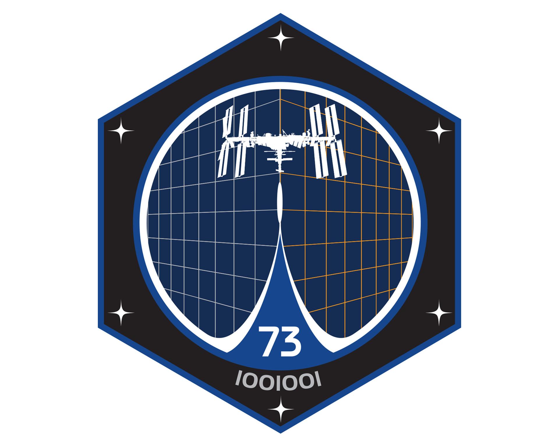
ARISS Russia Plan a SSTV Activity Period to Coincide with a Regional Holiday
ARISS (@arissintl.bsky.social) made a low key post at 14:38 on 01/05/2025: Link to original post.
Original Post Details
A special ARISS-Russia SSTV event is on the ISS scheduled beginning May 5 at 12:00 UTC. This is a celebration commemorating a regional holiday.
This will impact the availability of APRS. Monitor 145.800 MHz for potential activity during passes.
Details are suprisingly sparse compared to previous ARISS ISS SSTV activity periods, there have been none of the usual ARISS announcements with graphics on Social Media and the best information has come from an independent Social Media post by HV2CWM.
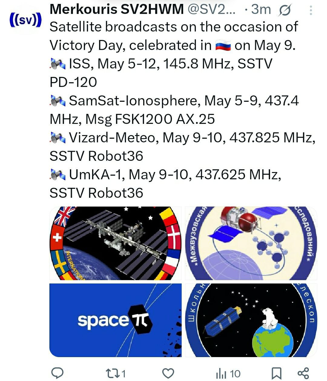
- Start: 12:00UTC on 05/05/2025
- End: possibly at an unknown time on 12/05/2025
- Transmission Breaks:
- None
- Updates:
- None
- On the ISS: Service Module Radio
- Callsign: Expected to be RS0ISS
- Frequency: 145.800MHz ± ~3kHz Doppler shift
- Mode: Expected to be PD120
- Images in Series: 12
- Image Gallery: Upload decoded images to the ARISS gallery in the “Expedition 73 Series 27” area
Note: Dates and times are subject to change due to ISS operational adjustments.
Table of ISS Passes
Address: Novers Park Community Association, Rear of 124 Novers Park Road, Bristol, BS4 1RN
- Latitude (degrees N-S where North is +ve): 51.425358°
- Longitude (degrees E-W where East is +ve): -2.593782°
- IARU (Maidenhead) Locator [Calculated by Spreadsheet]: IO81qk
- Elevation (metres above Ordnance Datum [AOD]): 64m
- What.Three.Words: ///Hugs.Sorry.Dime
AOD: In the UK Ordnance Datum is the mean sea level at Newlyn in Cornwall, elsewhere in the world the elevation above sea-level will be sufficiently accurate.
If you are reading this News post through Groups.io then, due to formatting limitations imposed by Groups.io, the colour banding may not show up in your post. For a full colour correctly formatted version please head over to the SBARC Website News Page and follow the “Read More” link under the headline and description.
Notes:

In the table below:
- Table Entries with a cyan background indicate passes where: 0° < Maximum Elevation ≤ 30°
- Table Entries with a yellow background indicate passes where: 30° < Maximum Elevation ≤ 60°
- Table Entries with a green background indicate passes where: 60° < Maximum Elevation ≤ 90°
- Times are UK clock time, that is GMT/UTC during the winter and BST/UTC+1:00 during the summer
- Elevation shows the degrees above the horizon. Zero degrees is the horizon and ninety degrees is directly overhead
- Azimuth represents the direction to the ISS using a traditional 16 cardinal point compass rose
| Pass No. |
Date | Acquisition of Signal “AoS” | Maximum Elevation | Loss of Signal “LoS” | Pass Duration (Min:Sec) |
Comments | ||||||
|---|---|---|---|---|---|---|---|---|---|---|---|---|
| UK Clock Time | Elevation | Azimuth or Bearing |
UK Clock Time | Elevation | Azimuth or Bearing |
UK Clock Time | Elevation | Azimuth or Bearing |
||||
| 01 | 06/05/25 | 00:21:31 | 10° | SW | 00:24:40 | 38° | SSE | 00:27:49 | 10° | E | 06:18 | Tue – visible |
| 02 | 06/05/25 | 01:57:56 | 10° | W | 02:01:18 | 89° | NW | 02:04:41 | 10° | E | 06:45 | Tue – visible |
| 03 | 06/05/25 | 03:34:45 | 10° | W | 03:38:07 | 79° | SSW | 03:41:30 | 10° | ESE | 06:45 | Tue – visible |
| 04 | 06/05/25 | 05:11:44 | 10° | W | 05:14:38 | 27° | SSW | 05:17:32 | 10° | SSE | 05:48 | Tue – daylight |
| 05 | 06/05/25 | 23:34:04 | 10° | SSW | 23:36:59 | 28° | SSE | 23:39:55 | 10° | E | 05:51 | Tue – night (unlit) |
| 06 | 07/05/25 | 01:10:09 | 10° | WSW | 01:13:31 | 80° | SSE | 01:16:53 | 10° | E | 06:44 | Wed – visible |
| 07 | 07/05/25 | 02:46:57 | 10° | W | 02:50:20 | 90° | SSW | 02:53:42 | 10° | E | 06:45 | Wed – visible |
| 08 | 07/05/25 | 04:23:49 | 10° | W | 04:26:57 | 37° | SSW | 04:30:06 | 10° | SE | 06:17 | Wed – visible |
| 09 | 07/05/25 | 22:46:48 | 10° | SSW | 22:49:20 | 20° | SE | 22:51:53 | 10° | E | 05:05 | Wed – night (unlit) |
| 10 | 08/05/25 | 00:22:23 | 10° | WSW | 00:25:43 | 66° | SSE | 00:29:04 | 10° | E | 06:41 | Thu – visible |
| 11 | 08/05/25 | 01:59:08 | 10° | W | 02:02:31 | 85° | N | 02:05:53 | 10° | E | 06:45 | Thu – visible |
| 12 | 08/05/25 | 03:35:57 | 10° | W | 03:39:14 | 50° | SSW | 03:42:29 | 10° | SE | 06:32 | Thu – visible |
| 13 | 08/05/25 | 05:13:40 | 10° | WSW | 05:15:27 | 14° | SW | 05:17:14 | 10° | S | 03:34 | Thu – daylight |
| 14 | 08/05/25 | 21:59:53 | 10° | S | 22:01:43 | 14° | SE | 22:03:32 | 10° | ESE | 03:39 | Thu – visible |
| 15 | 08/05/25 | 23:34:40 | 10° | SW | 23:37:56 | 51° | SSE | 23:41:14 | 10° | E | 06:34 | Thu – visible |
| 16 | 09/05/25 | 01:11:17 | 10° | W | 01:14:40 | 85° | N | 01:18:02 | 10° | E | 06:45 | Fri – visible |
| 17 | 09/05/25 | 02:48:06 | 10° | W | 02:51:27 | 66° | SSW | 02:54:47 | 10° | ESE | 06:41 | Fri – visible |
| 18 | 09/05/25 | 04:25:18 | 10° | W | 04:27:50 | 20° | SW | 04:30:20 | 10° | SSE | 05:02 | Fri – visible |
| 19 | 09/05/25 | 22:47:02 | 10° | SW | 22:50:10 | 38° | SSE | 22:53:20 | 10° | E | 06:18 | Fri – visible |
| 20 | 10/05/25 | 00:23:26 | 10° | W | 00:26:48 | 90° | WNW | 00:30:11 | 10° | E | 06:45 | Sat – visible |
| 21 | 10/05/25 | 02:00:15 | 10° | W | 02:03:37 | 80° | SSW | 02:06:59 | 10° | ESE | 06:44 | Sat – visible |
| 22 | 10/05/25 | 03:37:13 | 10° | W | 03:40:08 | 28° | SSW | 03:43:03 | 10° | SSE | 05:50 | Sat – visible |
| 23 | 10/05/25 | 21:59:31 | 10° | SSW | 22:02:26 | 28° | SSE | 22:05:21 | 10° | E | 05:50 | Sat – visible |
| 24 | 10/05/25 | 23:35:35 | 10° | WSW | 23:38:57 | 80° | SSE | 23:42:19 | 10° | E | 06:44 | Sat – visible |
| 25 | 11/05/25 | 01:12:23 | 10° | W | 01:15:46 | 90° | NNW | 01:19:08 | 10° | E | 06:45 | Sun – visible |
| 26 | 11/05/25 | 02:49:14 | 10° | W | 02:52:24 | 38° | SSW | 02:55:32 | 10° | SE | 06:18 | Sun – visible |
| 27 | 11/05/25 | 21:12:12 | 10° | SSW | 21:14:43 | 20° | SE | 21:17:14 | 10° | E | 05:02 | Sun – daylight |
| 28 | 11/05/25 | 22:47:45 | 10° | WSW | 22:51:05 | 65° | SSE | 22:54:26 | 10° | E | 06:41 | Sun – visible |
| 29 | 12/05/25 | 00:24:30 | 10° | W | 00:27:52 | 85° | N | 00:31:14 | 10° | E | 06:44 | Mon – visible |
| 30 | 12/05/25 | 02:01:19 | 10° | W | 02:04:36 | 51° | SSW | 02:07:52 | 10° | SE | 06:33 | Mon – visible |
| 31 | 12/05/25 | 03:38:59 | 10° | WSW | 03:40:48 | 14° | SW | 03:42:39 | 10° | S | 03:40 | Mon – night (unlit) |
| 32 | 12/05/25 | 20:25:15 | 10° | S | 20:27:02 | 14° | SE | 20:28:49 | 10° | ESE | 03:34 | Mon – daylight |
| 33 | 12/05/25 | 21:59:58 | 10° | SW | 22:03:14 | 50° | SSE | 22:06:31 | 10° | E | 06:33 | Mon – visible |
| 34 | 12/05/25 | 23:36:35 | 10° | W | 23:39:58 | 85° | N | 23:43:20 | 10° | E | 06:45 | Mon – visible |
| 35 | No Pass Data | |||||||||||
| 36 | No Pass Data | |||||||||||
| 37 | No Pass Data | |||||||||||
| 38 | No Pass Data | |||||||||||
| 39 | No Pass Data | |||||||||||
| 40 | No Pass Data | |||||||||||
| 41 | No Pass Data | |||||||||||
| 42 | No Pass Data | |||||||||||
| 43 | No Pass Data | |||||||||||
| 44 | No Pass Data | |||||||||||
| 45 | No Pass Data | |||||||||||
| 46 | No Pass Data | |||||||||||
| 47 | No Pass Data | |||||||||||
| 48 | No Pass Data | |||||||||||
| 49 | No Pass Data | |||||||||||
| 50 | No Pass Data | |||||||||||
| 51 | No Pass Data | |||||||||||
| 52 | No Pass Data | |||||||||||
| 53 | No Pass Data | |||||||||||
| 54 | No Pass Data | |||||||||||
| 55 | No Pass Data | |||||||||||
| 56 | No Pass Data | |||||||||||
| 57 | No Pass Data | |||||||||||
| 58 | No Pass Data | |||||||||||
| 59 | No Pass Data | |||||||||||
| 60 | No Pass Data | |||||||||||
If you want to run your own location specific pass predictions try using:
- The AMSAT On line satellite pass predictions
- The Heavens Above website
The AMSAT site will require either:
- Method 1
- Your 6 character IARU (Maidenhead) locator square (e.g. IO81qk); and
- Your elevation in metres (e.g. 64).
- Method 2
- The absolute (without +ve or -ve sign) value of your Latitude in decimal degrees and selecting North where the original value is positive (greater than 0) or selecting South where the original value is negative (less than 0) (e.g. 51.425358 North);
- The absolute (without +ve or -ve sign) value of your Longitude in decimal degrees and selecting East where the original value is positive (greater than 0) or selecting West where the original value is negative (less than 0) (e.g. 2.593782 West);
- Your elevation in metres (e.g. 64).
The Heavens Above site is more flexible and will accept any of:
- Method 1
- Your address including postcode (e.g. Novers Park Community Association, Rear of 124 Novers Park Road, Bristol, BS4 1RN); and
- Your elevation in metres (e.g. 64).
- Method 2
- Your What.Three.Words location descriptor (e.g. ///hugs.sorry.dime); and
- Your elevation in metres (e.g. 64).
- Method 3
- Your Latitude in decimal degrees where +ve is north of the equator and -ve is south of the equator (e.g. 51.425358);
- Your Longitude in decimal degrees where +ve is east of the Greenwich Meridian and -ve is west of the Greenwich Meridian (e.g. -2.593782); and
- Your elevation in metres (e.g. 64).
When using Heavens Above don’t forget to check that you have the correct timezone (e.g. (GMT +0:00) United Kingdom/Ireland)
Heavens Above understands British Summer Time and corrects accordingly